Ancestral Baltic Lands
- kapochunas
- Nov 20, 2023
- 1 min read

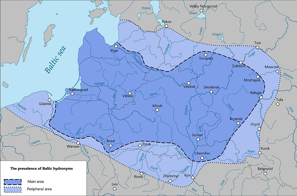
The prevalence of Baltic hydronyms, by Serious Thinker, a wikipedia editor who created the map while editing the page https://en.wikipedia.org/wiki/Proto-Baltic_language
"Main Area" is defined as having many Baltic hydronyms (names of bodies of water), and extends east almost to Moscow, including today's Belarus, and west to Russia's Kaliningrad Oblast and almost to Warsaw. "Peripheral Area" is defined as having few or questionable Baltic hydronyms. Looks like Lithuania's ancestral lands.
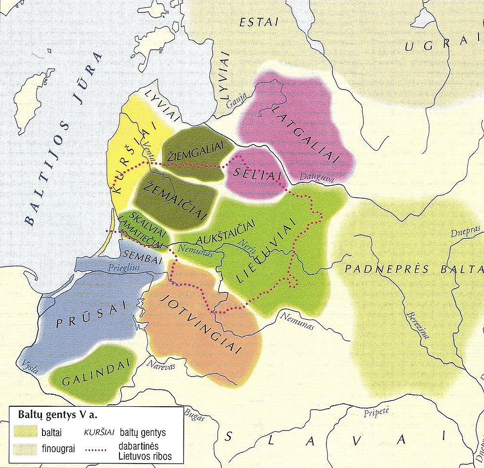
Here's where Baltic tribes were located in the Fifth Century:

Baltu gentys V a. (Baltic tribes in the 5th cent.) after Marija Gimbutas.
"Finougrai" are Finno-Ugric tribes; the dotted red lines are the borders of today's Lithuania.
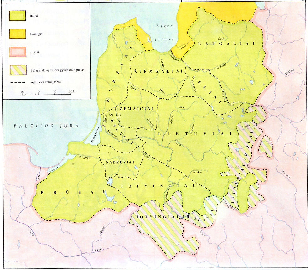
Balts from 800 to 1200:

Baltų Gentys IX - XII a. (Baltic Tribes 801 - 1200). Vilnius. From Pradai's "Mokyklinis Lietuvos Istorijos Atlasas." A. Kapochunas collection.
The diagonal yellow areas are mixed Baltic and Slavic.
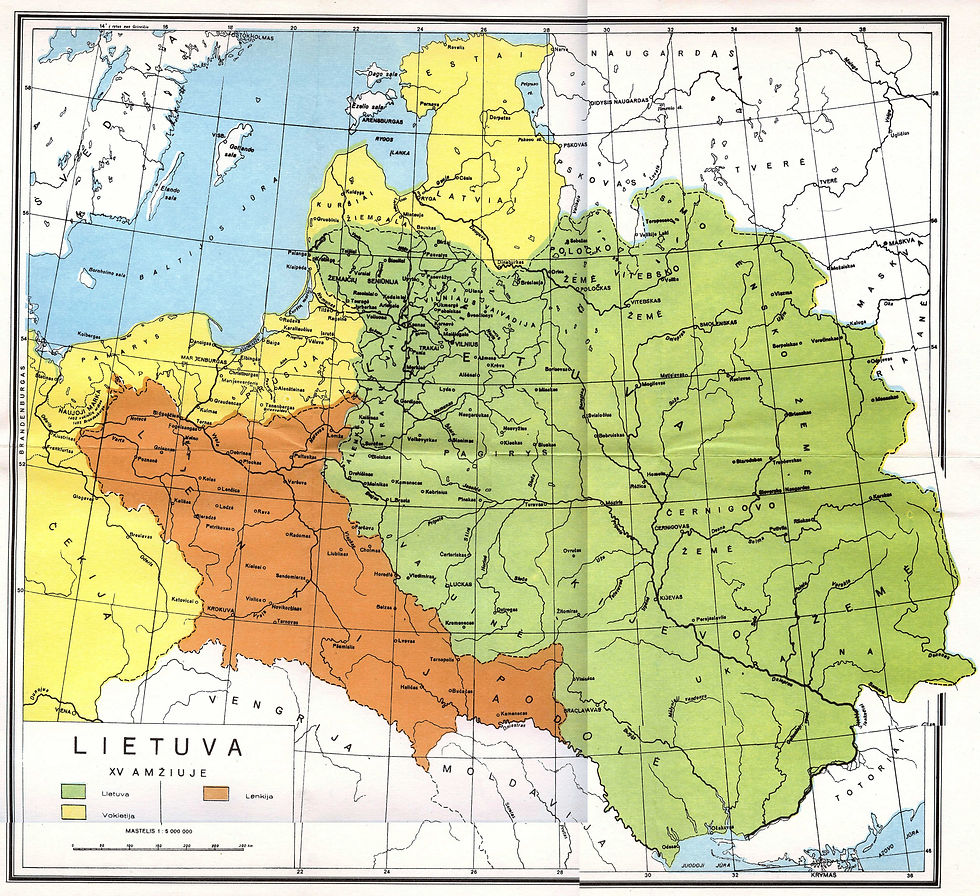
Lithuania in the 15th century, in green, with Poland in orange, German areas in yellow:

Lietuva: XV Amžiuje (Lithuania in the 15th Century) https://www.lithuanianmaps.com/MapsHistoricalUpTo1795.html
Last: the Grand Duchy after the 1569 Union of Lublin, in 1654:

Lithuania and its Administrative Divisions (1654) by M.K. at wikimedia
Easy to see why the names of rivers and lakes in the area of the first map's "Main" area would have Baltic derivation.


Comments