New Antique Map Not At LithuanianMaps.com
- kapochunas
- Jun 23, 2021
- 1 min read

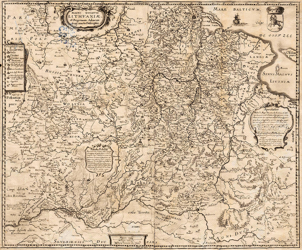
1739 [dated] Johann Gabriel Doppelmayr (mapmaker for Johann Homann) - Homann (Erben) Heirs (publisher) - Johann Ernst Adelbauer (printer): "Regni Poloniӕ, Magnique Ducatus g. Lithuaniӕ Nova et exacta tabula, ad mentem STAROVOLCII descripta" (A new and detailed map of the Kingdom of Poland and the Grand Duchy of Lithuania, described according to Starovolski) Nürnberg, from the "Atlas factice," a collection of maps issued by the Johann Baptist Homann/Homann Erben firm beteen 1710 and 1786, made by various cartographers. Note the poorly-erased old engraving in the Fifth State of the cartouche. Szymon Starovolski (1588-1656) , also known as Starowolski and as Simon Starovolscius -- born into an impoverished Lithuanian noble family -- was a historian, geographer and prolific author on the Polish-Lithuanian Commonwealth. See the other states of the cartouche at LithuanianMaps.com: states: #1: 1712; #2: 1715-18; #3: 1729; #4: 1730-38. Image from RareMaps.com. Johann Baptiste Homann (1664 - 1724) was a self-taught copper engraver who founded his own cartographic/publishing firm in 1702, with his first atlas published 1707. He was appointed Geographer to the Holy Roman Emperor Charles VI in 1715. His son and successor, Johann Christoph (1703 - 1730) was also an engraver and publisher who ran the business from 1724 to his death in 1730, whereupon the company became known as Homann (Erben) Heirs, and by 1813 had issued over 900 maps.


Comments