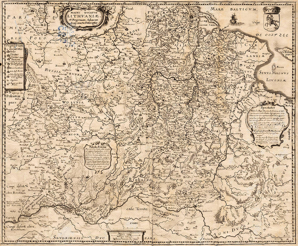
"The Maps and Mapmakers that Helped Define 20th-Century Lithuanian Boundaries."
- kapochunas
- Mar 16
- 1 min read
Updated: Mar 25

As I prepare for the inevitable shutting down of the static website LithuanianMaps.com (in 2027?) and for its successor site: https://lietuvoskartografija.lt/lithuanianmaps/ to be the sole location of the 4,300+ map images and text I created from 2008-21, I want to make certain that all the articles I have written, all the map-related presentations I have given, and the 669 topographical maps, survive in an easy-to-access location.
My new site now has links to my articles, and a page with links to my presentations is in progress. Next up is figuring out how to display the topo maps in a "Mapster-like" format that will make it easy to find the topo map you're looking for. Until that's done, I'm keeping the old site -- and its downloadable maps and links -- live.


Comments