The Oddest Antique Map of Lithuania
- kapochunas
- Jun 4
- 2 min read
Updated: Jun 9

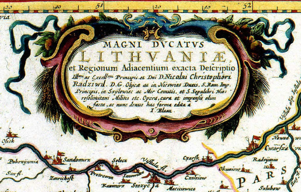
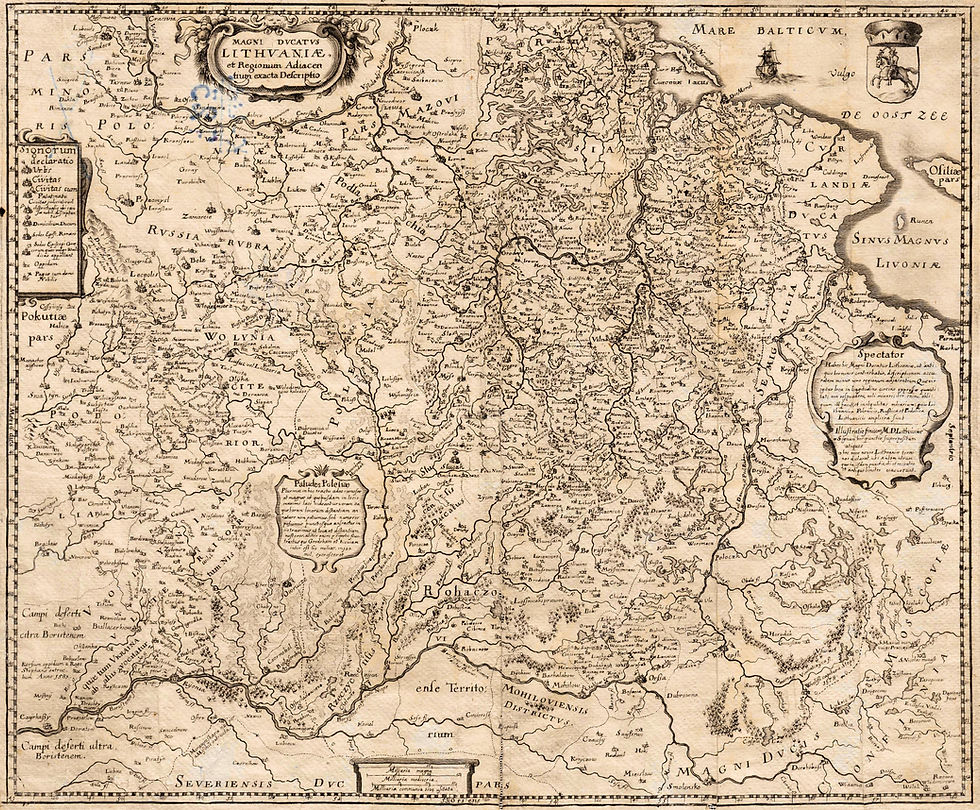
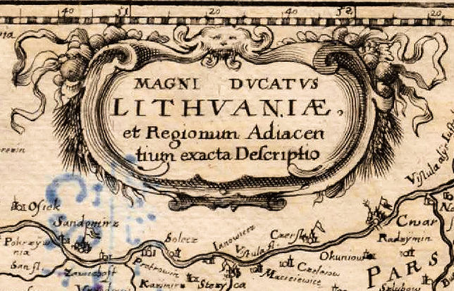
In 1648-49 Joan Blaeu first published a flipped-on-the-side (so that compass North is on the right) and reduced (44 x 52 cm vs. 76 x 74 cm) version of his seminal dated-1613 map "MAGNI DVCATUS LITHVANIAE." for the "Atlas Maior." A second state of the plate, published 1649-72, can be identified by a change in the latitude labels on the upper right frame, courtesy of Algimantas Muzikevičius:

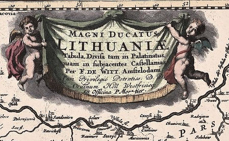
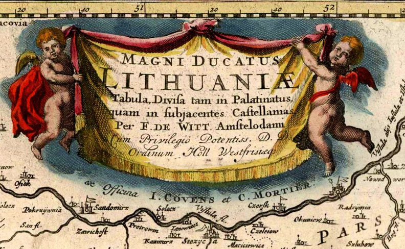
After the Blaeu print shop burned down in 1672, the 2nd state of plate was sold at auction in 1674 to Frederick de Wit. The Blaeu firm kept selling their version of the map from copies surviving the fire until 1695. Meanwhile, assuming the Blaeu 2nd State plate was still usable (he could have created a new plate), Wit replaced Blaeu's name in the cartouche with his own, eliminated a secondary cartouche in the middle of the map, made changes to Lithuania's geography, and published it from 1697 - 1704. Pieter Mortier bought Wit's plate in 1710, added the line "ex Officina P. Mortier" to the cartouche, publishing it until 1721. After 1721, the P. Mortier imprint was removed, and a new line was added beneath the cartouche: "ex Officina I. COVENS et. C. MORTIER."
According to George Carhart in his beautiful book https://www.amazon.com/Frederick-Concise-Reference-Explokart-Cartography/dp/9004299033. on Frederick de Wit, there were three additional versions of Blaeu's North-on-the-right plates. Here's how to tell them apart by the main cartouche, and the dates Carhart says they appeared in atlases:

As a result of my research, especially the comments from Algimantas Muzikevičius, I learned that the Wit map I bought in 2000 is the 5th State, and that the "c. 1638 Caspar (not Matthäus) Merian: "Magni Dvcatvs LITHVANIÆ ...," map I bought from Jonathan Potter in 2010 is actually a reduction of Blaeu's 1648 plate, and was first published in 1672. I reproduce the map and cartouche below, because I believe you may still find map sources saying it pre-dates the Blaeu North-on-the-right map:
And, of course, now I need to have the dates and states for all these maps corrected at https://lietuvoskartografija.lt/lithuanianmaps/


Comments